
“Location is the new index for truth in data.” — Jack Dangermond, Esri Founder In 2025, 90% of all data has a spatial component — yet most analysts still treat location as an afterthought. At Spectrum GIS Solutions, we fuse descriptive statistics, spatial autocorrelation, and predictive modeling inside GIS to deliver insights that spreadsheets alone […]
Author Archives: spectrum.gis

14
Nov
Nov
GIS in Emergency Services: Saving Lives with Location Intelligence By The Spectrum GIS Team at www.spectrumgis.co When seconds count, location is everything. From the moment a 911 call comes in to the final evacuation order, Geographic Information Systems (GIS) are the invisible backbone of modern emergency response. At Spectrum GIS Solutions, we’ve helped fire departments, […]

14
Nov
Nov
Maps are humanity’s oldest data visualization tool — and they’re still evolving faster than ever. What began as scratches on cave walls now powers real-time flood alerts, self-driving cars, and climate models that predict the next century. At Spectrum GIS Solutions, we live at the cutting edge of this 10,000-year journey. Here’s how maps evolved […]

14
Nov
Nov
Weather isn’t just small talk — it’s data, and GIS is the lens that turns it into action. From predicting flash floods to optimizing renewable energy, geospatial weather intelligence is now a cornerstone of governance, agriculture, logistics, and disaster response. At Spectrum GIS Solutions, we integrate live weather feeds with spatial analytics to help clients […]

14
Nov
Nov
QGIS (formerly Quantum GIS) is the world’s most powerful open-source Geographic Information System — and it’s 100% free. Used by governments, Fortune 500 companies, NGOs, and independent analysts alike, QGIS delivers the same core capabilities as commercial tools like ArcGIS Pro — without the licensing fees. At Spectrum GIS Solutions, we train teams on QGIS […]
13
Nov
Nov
Governments collect more location data than ever, yet many still make decisions on spreadsheets and static maps. That’s where Geographic Information Systems (GIS) step in—turning spatial intelligence into faster, fairer, and more transparent governance. At Spectrum GIS Solutions, we’ve helped municipalities, state agencies, and federal bodies deploy GIS to solve real problems: from equitable resource […]

13
Nov
Nov
In an era where cities are growing faster than ever, decision-makers need tools that turn raw data into actionable intelligence. At Spectrum GIS Solutions, we’re at the forefront of this transformation, leveraging cutting-edge Geographic Information Systems (GIS) to map out smarter, more sustainable urban futures. If you’re in urban planning, environmental management, or infrastructure development, […]
13
Nov
Nov
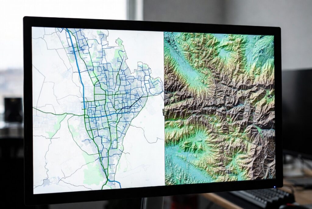
GIS data types, vector vs raster, GIS for beginners

13
Nov
Nov
Welcome to the world of Geographic Information Systems (GIS)! If you’re new to spatial data, mapping technologies, or how location intelligence can transform decision-making, you’re in the right place. At Spectrum GIS Solutions, we specialize in helping businesses, governments, and organizations unlock the power of GIS for real-world applications. This post is your starting point—a […]
Welcome to WordPress. This is your first post. Edit or delete it, then start writing!