Welcome to the world of Geographic Information Systems (GIS)! If you’re new to spatial data, mapping technologies, or how location intelligence can transform decision-making, you’re in the right place. At Spectrum GIS Solutions, we specialize in helping businesses, governments, and organizations unlock the power of GIS for real-world applications. This post is your starting point—a straightforward breakdown of the essentials. No jargon overload, just the fundamentals to get you mapping like a pro.
Whether you’re in urban planning, environmental management, or logistics, understanding GIS basics will open doors to smarter, data-driven strategies. Let’s break it down step by step.
What is GIS, Anyway?
At its core, GIS is a framework for capturing, storing, manipulating, analyzing, and displaying spatial or geographic data. Think of it as a supercharged digital map that doesn’t just show where things are, but why they matter and how they connect.
- Key Components:
- Hardware: Computers, GPS devices, and scanners for data input.
- Software: Tools like ArcGIS, QGIS, or our custom platforms at Spectrum GIS for processing and visualization.
- Data: Layers of information, from satellite imagery to street addresses.
- People: Analysts and decision-makers who interpret the insights.
- Methods: Analytical techniques to overlay and query data.
Fun fact: GIS has roots in the 1960s, but today it’s powering everything from disaster response to personalized navigation apps.
Why GIS Matters in 2025
In a world flooded with location-based data (hello, IoT sensors and drones!), GIS turns chaos into clarity. Here’s why it’s a must-know:
- Efficiency Gains: Optimize routes for delivery fleets, saving time and fuel.
- Risk Mitigation: Model flood zones or wildfire spreads for proactive planning.
- Sustainability: Track deforestation or urban heat islands to promote green initiatives.
- Business Edge: Retailers use it to pinpoint ideal store locations based on demographics.
The GIS market is booming—expected to exceed $15 billion by 2026—because it’s not just about maps; it’s about informed choices.
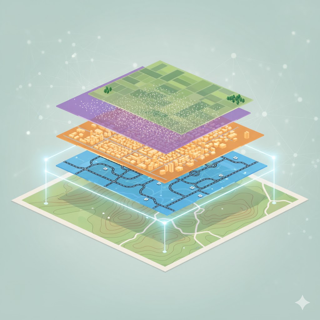
The Building Blocks: Core Concepts
Let’s demystify the basics with simple explanations:
- Spatial Data Types:
- Vector Data: Points (e.g., ATMs), lines (e.g., roads), and polygons (e.g., property boundaries). Precise and great for analysis.
- Raster Data: Grid-based pixels (e.g., satellite photos or elevation models). Ideal for continuous surfaces like temperature maps.
- Coordinate Systems:
- Locations are defined by latitude/longitude or projected grids (like UTM). Pro tip: Always check your projections to avoid “map mismatches”!
- Layers and Overlays:
- Stack data like pancakes: Add a soil layer over a land-use map to spot erosion risks. This is where GIS magic happens—revealing patterns invisible on paper.
- Basic Analysis Tools:
- Buffering: Create zones around features (e.g., 500m around schools for no-build areas).
- Overlay: Combine layers to find intersections (e.g., where fertile soil meets flood-prone rivers).
- Querying: Ask questions like “Show all parks within 2km of hospitals.”
Getting Hands-On: Free Tools to Start With
No need for expensive software right away. Dive in with these beginner-friendly options:
| Tool | Why It’s Great For Basics | Cost | Learning Curve |
|---|---|---|---|
| QGIS | Open-source powerhouse with tons of plugins. | Free | Low—intuitive interface. |
| Google Earth Pro | Visual exploration of global data. | Free | Very low—drag-and-drop fun. |
| ArcGIS Online | Esri’s cloud platform for quick maps. | Free tier | Medium—great tutorials. |
| Leaflet.js | For web devs wanting interactive maps. | Free | Medium if you code. |
At Spectrum GIS, we build on these foundations with custom integrations—think seamless API connections for real-time data feeds.
Common Pitfalls for Newbies (And How to Avoid Them)
- Data Overload: Start small—one layer at a time.
- Ignoring Accuracy: Validate sources; GPS can drift!
- Forgetting the ‘Why’: Always tie analysis back to a business question.
- Scalability Blind Spots: Test on small datasets before going big.
Your Next Steps with Spectrum GIS
Ready to apply these basics? Spectrum GIS Solutions offers entry-level workshops, free data audits, and tailored consulting to bridge theory and practice. Head to www.spectrumgis.co/contact for a no-obligation chat.
GIS is accessible, powerful, and endlessly fascinating. What’s your first project idea—a neighborhood map or a site suitability analysis? Share in the comments—we’re excited to hear and help!
Stay tuned for our next post: “GIS in Action—Real-World Case Studies.” Follow us for more tips!